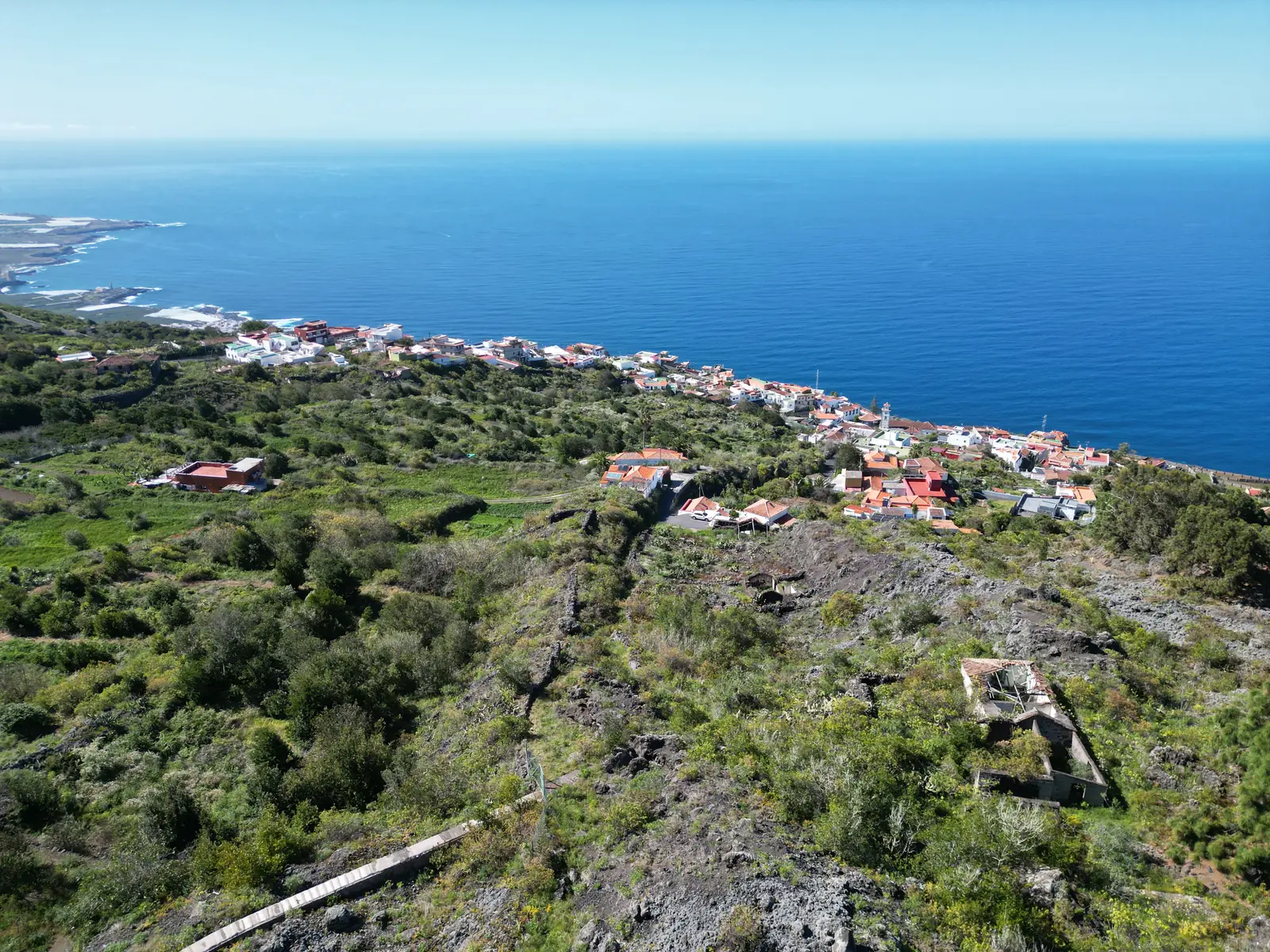
The area.
El Tanque lies at around 500 metres in the green north-west of Tenerife, between the Teno mountains and the Atlantic. Here is what we most like to recommend to our guests: places, restaurants, hikes and places to swim.
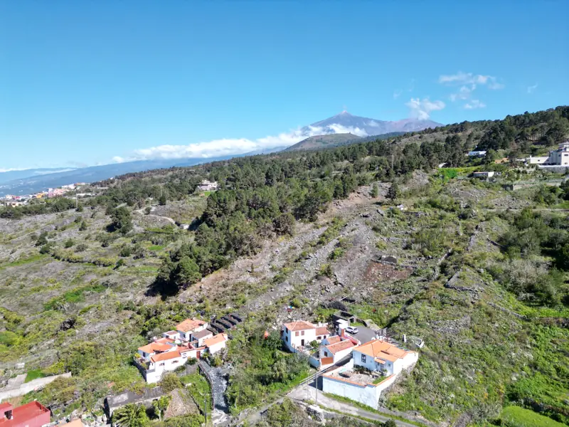 El TanqueWhere you stay
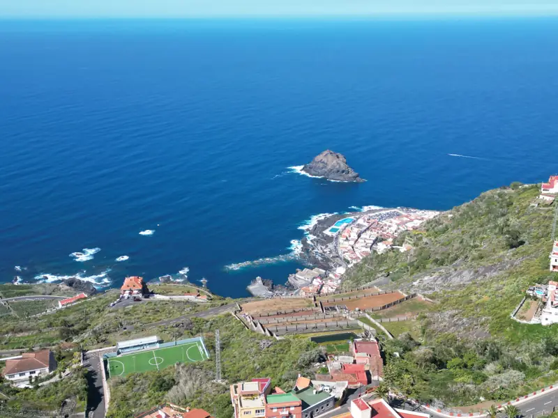 Garachico15 minutes by car
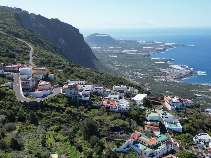 Buenavista del Norte20 minutes by car
Places nearby
Times are approximate driving times from El Tanque.
-
El Tanque
Where you stay
A mountain village at around 500 metres with about three thousand inhabitants. Worth seeing is the church of San Antonio de Padua in Tanque Bajo, rebuilt after the eruption of 1706. In Los Partidos, the Ecomuseo shows how grain used to be grown and threshed here.
Open in maps ↗ -
Garachico
15 minutes by car
Once the island’s main port, buried in 1706 by the lava flow that erupted above El Tanque. Today one of Tenerife’s loveliest old towns: Puerta de Tierra, Plaza de la Libertad, the Castillo de San Miguel fortress and, offshore, the Roque de Garachico.
Open in maps ↗ -
Icod de los Vinos
15 minutes by car
Wine town with the Drago Milenario, the most famous dragon tree of the Canaries, in the Parque del Drago. You can also see it free of charge from the Plaza de la Pila.
Open in maps ↗ -
Cueva del Viento
Icod, 20 minutes
One of the longest lava tubes in Europe. Visits only on a guided tour booked online; sturdy shoes are required.
Book a tour ↗ -
Los Silos
15 minutes by car
A quiet village in the Isla Baja valley with a lovely square. Farmers’ market on Sundays on the Plaza de la Luz; starting point for hikes to Cuevas Negras.
Open in maps ↗ -
Buenavista del Norte
20 minutes by car
The westernmost town in the north and gateway to the Teno mountains, with a beach and good fish restaurants. The bus to Punta de Teno leaves from here.
Open in maps ↗ -
Punta de Teno
Bus from Buenavista
Tenerife’s western tip, with a lighthouse and views of the Los Gigantes cliffs. Because of roadworks on the access road it can currently only be reached on bus 369 from Buenavista, not by car, on foot or by bike.
Open in maps ↗ -
Masca
30 minutes on a winding mountain road
The famous mountain village at 600 metres between steep rocks. The road is narrow and sometimes closed and parking is scarce, so it pays to go early.
Open in maps ↗ -
Santiago del Teide
20 minutes by car
A town on the pass to the south. The compulsory shuttle to the Masca gorge and the path to the Chinyero volcano start here.
Open in maps ↗ -
Los Gigantes
35 minutes by car
Cliffs up to 500 metres high above the sea, and a small harbour with boat trips to see dolphins and whales.
Open in maps ↗ -
Teide-Nationalpark
about 75 minutes by car
Spain’s highest mountain and a lunar landscape above 2,000 metres. Book the cable car online in advance; the path to the summit needs a separate permit, and some other trails also require a reservation. Dress warmly.
Book the cable car ↗ -
Puerto de la Cruz
40 minutes by car
A lively resort with an old town, harbour and promenade in the Orotava valley.
Open in maps ↗ -
Loro Parque
Puerto de la Cruz, 40 minutes
Opened in 1972 as a parrot park, today a large zoo with orcas, dolphins, gorillas and the Planet Penguin house.
Open in maps ↗ -
Jardín Botánico
Puerto de la Cruz, 40 minutes
Laid out in 1788 by order of King Charles III so that plants from the Americas and Asia could acclimatise before being sent on to Madrid.
Open in maps ↗ -
Mirador La Goleta
Anaga, about 75 minutes
Viewpoint in the Anaga mountains in the north-east of the island, easy to combine with the Hija Cambada trail.
Open in maps ↗ -
La Laguna
50 minutes by car
The old capital, a UNESCO World Heritage Site, with colourful colonial houses and plenty of bars; close to Tenerife North airport.
Open in maps ↗
Food & drink
Our favourite places to eat – in the village, in Garachico and a little further afield. Canarians eat late; in the evening it is worth booking almost everywhere.
-
Tasca El Comisario
El Tanque
A small tasca in the village, just a few steps from the finca.
Open in maps ↗ -
Restaurante Paganini
El Tanque
Italian restaurant and pizzeria with a cosy dining room; the pizza, pasta and lasagne are much praised.
Open in maps ↗ -
Pizzería La Albahaca
El Tanque
Small pizzeria on the main road with thin, crispy pizzas and good desserts.
Open in maps ↗ -
El Caletón Restaurante Chill Out
Garachico
Right by the El Caletón rock pools: fish and seafood, paella and octopus, with wines from Tenerife.
Open in maps ↗ -
Ardeola Arrocería
Garachico
Rice dishes on the seafront with a terrace facing the sea, such as rice with monkfish and prawns or with lobster.
Open in maps ↗ -
Tasca El Muelle Viejo
Garachico
Tapas by the old harbour: octopus, papas arrugadas with mojo, seafood and goat’s cheese.
Open in maps ↗ -
Restaurante Silogía
Garachico
In the old town palace of Hotel La Quinta Roja, with a courtyard: Canarian cooking with Mediterranean and Asian touches, awarded a Solete by the Guía Repsol.
Open in maps ↗ -
Casanova
Garachico
Restaurant in the old town of Garachico, one of our favourites.
Open in maps ↗ -
Pizzería Casa La Agraria
Garachico
Pizza in a lovely courtyard in the old town, with vegan antipasti too.
Open in maps ↗ -
Restaurante Q'Arepas
Icod
Venezuelan arepas with meat, cheese, plantain or avocado – relaxed and good.
Open in maps ↗ -
El Guanche – Alte Schule
Masca
In Masca’s old village school: Canarian home cooking with views of the mountains and the village. Usually open during the day only.
Open in maps ↗ -
KV Bar Gourmet
Los Gigantes
Small restaurant by the harbour in Los Gigantes with modern, French-influenced cooking, fresh fish and good meat.
Open in maps ↗ -
El Rincón de Edu
San Juan de la Rambla
Canarian food in guachinche style, in the middle of a banana plantation; try the plantain tortilla and the almogrote. Parking is limited.
Open in maps ↗ -
Arepera La Carajita
Puerto de la Cruz
Venezuelan arepera since 1985, with arepas, cachapas and tequeños, also sweet with guava and cheese.
Open in maps ↗ -
Bodegas Viñátigo
La Guancha · winery
Tours and tastings by appointment, explaining the grape varieties, growing and climate of the north.
Open in maps ↗ -
Guachinches
All over the north
Typical of northern Tenerife: winegrowers serve their own wine with simple dishes such as chickpeas, goat or potatoes with mojo. They only open for a few months a year, usually from autumn to spring; call ahead or ask us.
Hiking
The north-west is one of the island’s finest hiking areas. After storms the island government sometimes closes trails; check Tenerife ON before you set off.
-
San Juan del Reparo – Garachico
Old mule track
Down the paved camino in zigzags across the 1706 lava to Garachico, always with a view of the town and the sea. Back by bus or taxi.
4.5 km1.5 hours500 m downhillOpen in maps ↗ -
Montaña Chinyero
PR-TF 43.1 from San José de los Llanos
Through pine forest to the Chinyero volcano, which last erupted in 1909, with a loop around the crater. Starts in a part of El Tanque.
4.3 km one way1.5 hourseasyOpen in maps ↗ -
Monte del Agua
PR-TF 52 Erjos – Las Portelas
Through the laurel forest of the Teno nature park and down into the El Palmar valley. Often misty and magical.
10.7 km2.5 hoursmoderateOpen in maps ↗ -
Charcas de Erjos
Walk from Erjos
A short path to the Erjos ponds between fields and forest. The ponds are often empty in dry years, but the walk is lovely anyway.
about 4 km there and backeasyOpen in maps ↗ -
Cuevas Negras
PR-TF 53 Erjos – Los Silos
Almost entirely downhill through a deep ravine, past the abandoned hamlet of Cuevas Negras to Los Silos.
5.7 km3 hoursmoderate, 900 m downhillOpen in maps ↗ -
Teno Alto
Loops from El Palmar or Teno Alto
The high plateau of the Teno mountains with pastures, goats and wide views over the west coast.
3 to 9 kmup to just over 3 hoursmoderate to hardOpen in maps ↗ -
Barranco de Masca
Reservation only
Tenerife’s best-known gorge, from Masca down to the sea and back by boat to Los Gigantes. Demanding; only with an online reservation, a helmet and hiking boots.
5 km downhill4 to 6 hourshardReserve ↗ -
Sendero Las Aguas
Coastal path near San Juan de la Rambla
From San Juan de la Rambla past the hamlet of Las Aguas to El Rosario, always by the sea. If you like, climb up through the Barranco de Ruiz.
about 3 kmOpen in maps ↗ -
Rambla de Castro
Coastal path near Los Realejos
Through the Rambla de Castro protected landscape, past the Casona de Castro manor and the Fortín de San Fernando, down to the coves of Playa Castro and Playa de los Roques. Better for looking than for swimming.
easyOpen in maps ↗ -
Hija Cambada
Anaga, from Cruz del Carmen
Through the laurel forest of the Anaga mountains, with tunnels of trees and old trunks that have sprouted anew. Starts at the Cruz del Carmen car park on the TF-12.
Open in maps ↗
Swimming in the Atlantic
On the north coast the sea is often rough, with surf and currents, especially in winter. Never go into natural pools or onto rock platforms in high waves, and follow the flags.
-
El Caletón
Garachico
Natural pools in the 1706 lava, with steps and showers, free of charge. Swimming is forbidden during wave warnings or with a red flag.
Open in maps ↗ -
Playa de San Marcos
Icod
A small, sheltered bay with black sand.
Open in maps ↗ -
Playa de Las Arenas
Buenavista
Black sand and pebbles on the open Atlantic, with a view of the Teno mountains.
Open in maps ↗ -
Charco del Viento
La Guancha
Natural pools on the rocky coast, lovely for swimming when the sea is calm.
Open in maps ↗ -
El Puertito
Los Silos
A small natural pool by the sea, quiet and little visited.
Open in maps ↗ -
Playa de Garachico
Garachico
Small cove of dark sand and pebbles beside the fishing harbour, sheltered by the breakwater.
Open in maps ↗ -
Charco Las Mujeres
Buenavista
Secluded cove of black sand and pebbles, about ten minutes on foot from Playa de Las Arenas. No lifeguards and often heavy surf: only swim when the sea is calm.
Open in maps ↗ -
Playa Jardín
Puerto de la Cruz, 40 minutes
Black lava-sand beach of three sheltered bays, with gardens and a promenade designed after César Manrique.
Open in maps ↗ -
Playa El Bollullo
La Orotava, 45 minutes
Dark-sand cove below cliffs among banana fields, reached only by a steep stepped path. Often waves and currents; the path has been closed at times because of rockfall.
Open in maps ↗ -
Playa de la Arena
Puerto de Santiago, 40 minutes
Black-sand beach with showers, sunbeds and lifeguards in season. The shore shelves steeply and the waves break hard.
Open in maps ↗ -
Playa de Alcalá
Alcalá, 45 minutes
Small village beach next to the fishing harbour, with showers, bars and restaurants; seawater pools nearby.
Open in maps ↗ -
Playa del Duque
Costa Adeje, about an hour
Light-sand beach in front of the Costa Adeje hotels, with sunbeds, showers and a promenade to other beaches.
Open in maps ↗
Good to know
Everything for everyday life in and around El Tanque: supermarkets, pharmacies and petrol stations are on the map too.
-
Alteza
El Tanque
Small supermarket in the village, for the essentials.
Open in maps ↗ -
Supermercados Garachico
Garachico
Supermarket in the centre of Garachico.
Open in maps ↗ -
Tu Alteza
La Caleta de Interián
Supermarket on the coast below El Tanque.
Open in maps ↗ -
Mercadona
Icod
Large supermarket with everything you need.
Open in maps ↗ -
Lidl
Icod
Discount supermarket on the edge of Icod.
Open in maps ↗ -
Farmacia
El Tanque
Pharmacy in the village, near the town hall.
Open in maps ↗ -
Farmacia
Garachico
Pharmacy in Garachico’s old town.
Open in maps ↗ -
Repsol
El Tanque
Petrol station in El Tanque.
Open in maps ↗ -
Supermercado Atalaya
El Tanque
Open in maps ↗
- Shopping A small supermarket in El Tanque, more choice in Garachico and Icod (Mercadona, SuperDino, Lidl).
- Farmers’ market Sundays from 9 am to 2 pm on the Plaza de la Luz in Los Silos.
- Pharmacy and fuel Pharmacy and petrol station in El Tanque, more in Garachico, Los Silos and Icod.
- Health Emergency number 112. Doctor’s surgery (consultorio) in El Tanque, health centre in Icod; the Hospital del Norte is about 15 minutes away near Icod.
- Weather and clothing At 500 metres it is mild, but cooler and damper than on the coast and in the south. Trade-wind clouds often bring mist. Pack a jumper for the evenings and sturdy shoes for hiking; it can be cold in the Teide National Park.
- Airports Tenerife North about one hour, Tenerife South about one hour by car.
- Roads The roads to Masca and Punta de Teno are narrow and sometimes closed. A hire car is almost essential up here.
- Questions Write to us any time; we are happy to help with tips and reservations.
As of October 2026. Opening hours, prices and closures change; please check before you go.